New Plymouth Coastal Walkway: Wind Wand to Te Rewa Rewa Bridge
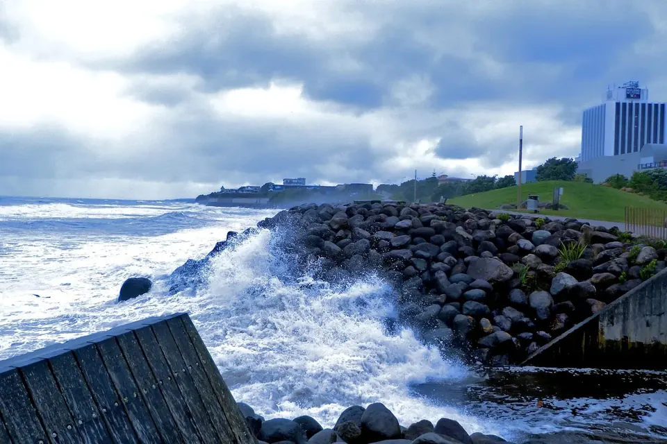
The New Plymouth Coastal Walkway is a shared path for walkers, runners and cyclists that follows the city's shoreline for about 13 kilometres, from Port Taranaki in the west to Bell Block in the east. It links the city centre with beaches, river mouths and parks, and on a clear day the mountain is in view for much of the way. Many visitors walk a short section; locals use it every day.
The walkway in brief
- Length
- About 12.7 kilometres one way, from the port area to Hickford Park in Bell Block.
- Surface
- Wide concrete path, almost entirely flat, suitable for prams, wheelchairs, scooters and bikes.
- Time
- Three to four hours to walk end to end; around an hour by bike at an easy pace.
- Facilities
- Toilets, drinking fountains and seats at intervals; cafés in the city centre and at several beaches.
Because it is a shared path, keep left, ring a bell or call out when passing on a bike, and slow down near the busier city-centre stretch. Dogs are allowed on a lead on most of the walkway, under New Plymouth District Council rules.
Port Taranaki to the city centre
The western end of the walkway starts near the port, with views back to Paritutu and the Sugar Loaf Islands. The path passes Ngāmotu Beach, the city's sheltered swimming beach, then runs along the seawall towards the centre. The seawall section is where the walkway feels most exposed: in a westerly swell, waves break hard against the rocks and spray can reach the path, which is part of the attraction for photographers. Take care here in rough weather.
The city waterfront
In the centre, the walkway becomes a promenade. Its best-known landmark is the Wind Wand, a 45-metre kinetic sculpture designed by the artist Len Lye and erected on the foreshore in 2000. The slender red tube bends and sways in the wind and carries a light at its tip that glows at night. Nearby stand Puke Ariki, the combined museum, library and visitor information centre opened in 2003, and the Len Lye Centre is a short walk inland. This is also the easiest point to join the walkway if you are staying in town.
East of the centre the path passes the mouth of the Huatoki Stream and East End Beach, with its surf club and reserve, then follows the shore towards Fitzroy and the Waiwhakaiho River. Fitzroy Beach is one of the city's main surf beaches and is patrolled in summer.
Te Rewa Rewa Bridge
The walkway's most photographed point is Te Rewa Rewa Bridge, a white pedestrian and cycle bridge across the Waiwhakaiho River mouth, opened in 2010. Its ribbed, curving structure is about 83 metres long. Some people see a breaking wave in its shape, others the skeleton of a whale; from the right spot at the western end, its arch neatly frames Taranaki Maunga. The land at the northern end of the bridge is an important site for Ngāti Tawhirikura, who were closely involved in the project, and an information panel explains its history.
Beyond the bridge to Bell Block
After the bridge, the walkway runs along clifftops and through Te Rewa Rewa Reserve before descending to Bell Block, a beach suburb at the eastern end. This stretch is quieter, with more birdlife and fewer people, and makes a good out-and-back walk or ride from the bridge. Some walkers continue along the beach at low tide; check tide times first, as the cliffs leave little room at high water.
Suggested outings
- Short city stroll (about 1 hour return): from Puke Ariki west along the waterfront past the Wind Wand and back.
- Bridge walk (2 hours return): from the city centre east along the shore to Te Rewa Rewa Bridge, crossing it before turning back.
- Full length by bike (2 to 3 hours return): port to Bell Block and back, with stops at the beaches; bikes can be hired in town.
- Sunset: the seawall and the Wind Wand face west over the sea and are popular at the end of the day.
Weather, light and timing
The walkway is open at all hours and lit in the central section, but it is at its best early in the morning, when the wind is often lightest and the mountain is more likely to be clear of cloud. Westerly winds blow straight onto this coast; on a blustery day, walking or riding east from the city puts the wind at your back for the outward leg, so plan the return accordingly. There is little shade along most of the route, and the reflected light off the sea and the pale concrete adds up, so sunscreen and water are worth carrying even on cooler days. After heavy rain, the river mouths run brown with sediment from the mountain streams and the beaches nearby are best avoided for swimming for a day or two.
Combining the walkway with other sights
The walkway links easily with other parts of the city. From the waterfront it is about fifteen minutes on foot to Pukekura Park; see our guide to Pukekura Park and the region's gardens. The Govett-Brewster Art Gallery and Len Lye Centre are a block from the Wind Wand. At the western end, the walkway connects with the start of Surf Highway 45, the coast road south.
Sources
- New Plymouth District Council, Coastal Walkway information and dog control rules: npdc.govt.nz.
- Len Lye Foundation, "Wind Wand": lenlyefoundation.com.
- Puke Ariki, history of the museum and library: pukeariki.com.
- Te Ara, the Encyclopedia of New Zealand, "New Plymouth": teara.govt.nz.
- Surf Life Saving New Zealand, patrolled beaches: surflifesaving.org.nz.